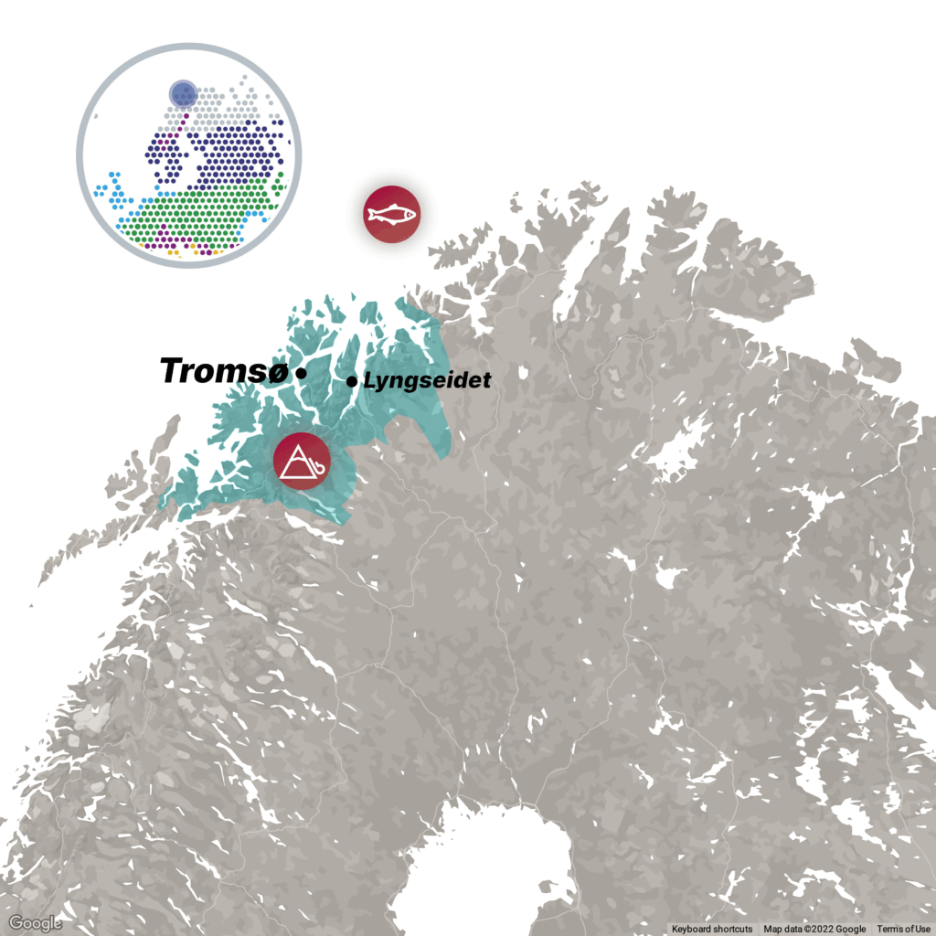
The IMPETUS Arctic demonstration site is located within Troms county, beyond the Arctic Circle in northern Norway. This region has a long arctic coastline boarding the Barents Sea to the north. Major economic sectors include fisheries, aquaculture, tourism, mining, oil and gas, and reindeer herding. Although the area spans over 25 000 km², with a population of ca 170 000 residents, communities and infrastructure face significant risks from natural hazards. These hazards, such as landslides, rockfalls, avalanches, and flooding, are exacerbated by climate change-induced factors including rising temperatures, increased precipitation, unstable snow cover, glacial retreat, and sea level rise.
Climate-Related Challenges
- Sustainable Management of Fisheries and Aquaculture : Climate change has had a noticeable impact on fisheries and aquaculture in northern Norway. Ocean waters are getting warmer and more acidic. Increase in marine disease and harmful algal blooms and the introduction of species put local ecosystems and aquaculture biomass under pressure. These damaging impacts could further accelerate and induce rapid changes to the coastal ecosystems.
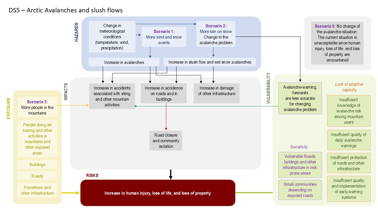
- Increasing Natural Hazard Risks : Rising temperatures and more frequent heavy precipitation events are contributing to a higher occurrence of natural disasters such as landslides and avalanches, posing risks to both the environment and human settlements.
- Flooding and Water Management Increased sea surface temperatures and the rising frequency of extreme weather events have led to the significant increase of the risk to urban and coastal infrastructure. Additionally, the risk of flooding is growing due to sea level rise, higher storm surge levels, and changes in precipitation patterns.
Key Actions
- Marine Spatial Planning: Developing a Marine Spatial Planning framework with relevant data on climate change and regional plans, while facilitating a platform where municipalities can discuss and propose climate adaptation measures, protection strategies and promote sustainable fisheries through spatial planning.
- Natural Hazard Risk Assessment: Conducting comprehensive risk assessments to understand future changes in avalanche and earth movement patterns. Developing early warning systems to mitigate the impact of these hazards.
- Stakeholder Engagement and Risk Awareness: Raising awareness among stakeholders and the public regarding the risks of sea level rise, storm surges and flooding through the digital twin. Engaging communities in risk assessments and planning efforts for inhabited areas at risk. Establishing a digital twin of Tromsø city to visualize the risks and have a fact-based platform for discussion and planning of climate adaptation measures.